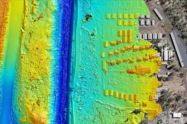
Aerial Surveying and Mapping
Our Aerial Surveying and Mapping services provide you with the georeferenced survey grade data necessary for effective project planning and execution. We offer a variety of outputs tailored to your requirements:
- Digital Orthomosaic: Gain a comprehensive overview of your project area with precise, georeferenced imagery.
- 2D and 3D Digital Terrain Models: Analyse terrain data in detail to inform project decisions.
- Elevation Models: Access elevation data crucial for accurate planning, all provided in convenient GIS data sets.
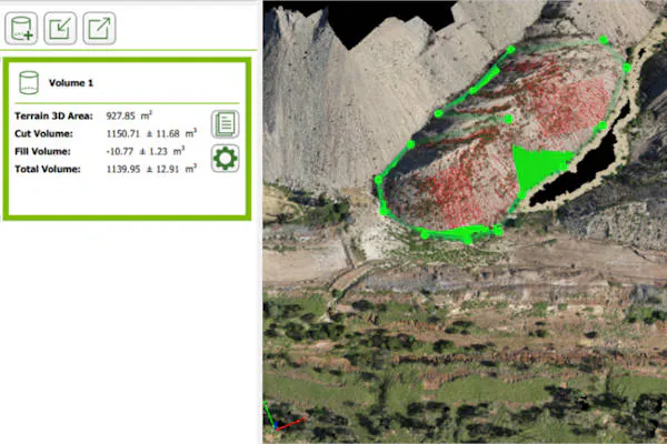
Environmental Management and Rehabilitation
For environmentally sensitive projects, our Environmental Management and Rehabilitation services offer invaluable support. We provide a range of solutions, including:
- Volumetric Measurement: Accurately measure volumes of materials, stockpiles, and more to facilitate environmental management.
- Digital Elevation Map: Obtain detailed digital elevation data to support environmental planning and assessment.
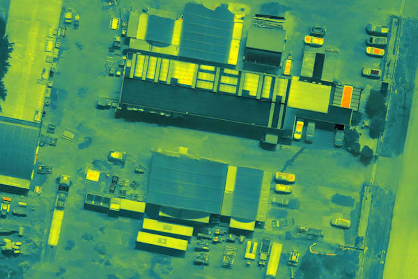
Thermal/Thermographic Survey
We perform thermographic inspections of your assets and provide you crucial data on their health and maintenance requirements. we were able to pick up detailed thermal information of the site. From this data, we are able to detect:
- Excessive heat/heat overflow
- Excessive cool
- Structural degradation
- Effectiveness of solar panels: photovoltaic survey
- Insulation degradation
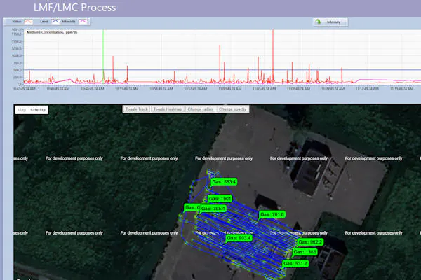
Gas Detection
Our remotely piloted aircraft use cutting-edge technology to revolutionise gas leak detection, so leaks can be identified accurately and safely:
- Methane Detection: detect and pinpoint methane leaks accurately, swiftly and efficiently.
- GIS-Ready Outputs: delivered in comprehensive GIS formats, integrating with your systems.
- Safety First: Let our drones handle dangerous inspections, at heights or in treacherous terrain.