Welcome to PSAH Drone Services
Elevating Your Projects With Precision Imagery
At PSAH Drone Services, we specialise in delivering super high-quality, georeferenced imagery to revolutionise the way you plan, manage, and execute land projects. Our cutting-edge Remotely Piloted Aircraft (RPA) technology empowers you to achieve new levels of efficiency, data precision, and environmental responsibility.
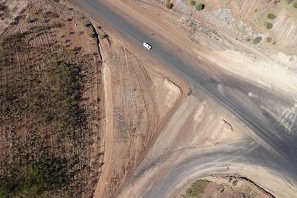
Aerial Surveying and Mapping
- Produce a range of georeferenced outputs, including digital orthomosaic, 2D and 3D digital terrain models, and elevation models, all in full GIS data sets.
- Digital Orthomosaic: Gain a comprehensive overview of your project area with precise georeferenced imagery.
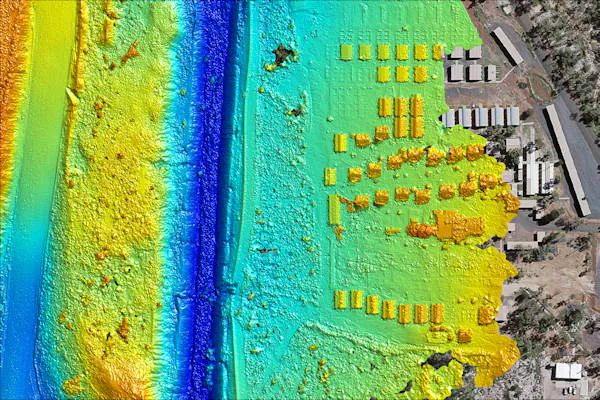
- 2D and 3D Digital Terrain Models: Analyse the terrain in detail for accurate project planning and execution.
- Elevation Models: Obtain elevation data for various applications, all in convenient GIS data sets.
Environmental Management and Rehabilitation
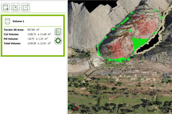
- We offer a comprehensive suite of services to support your environmental initiatives, including volumetric and stockpile measurements, runoff management, vegetation management, and geo-positioning, with all outputs provided as complete GIS data sets.
- Volumetric Measurement: Accurately measure volumes of materials, stockpiles, and more to support your environmental management efforts.
- Digital Elevation Map: Access precise digital elevation data to aid in environmental planning and assessment.
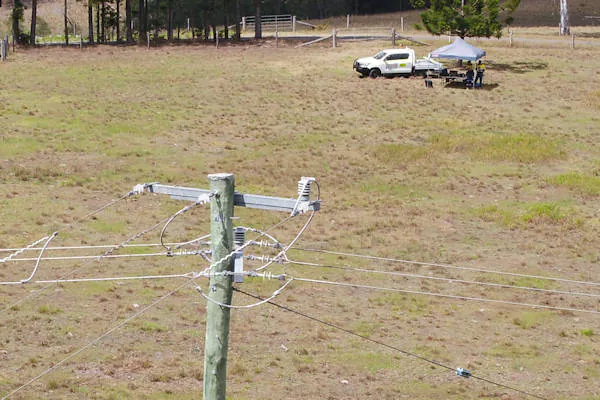
Aerial Asset Inspections
Our high-quality imaging and 4K video capabilities enable a wide range of inspections, including boundary line/fence inspections, powerline inspections, structures, silos, roof inspections, and solar panel inspections, even in inaccessible areas, at heights, or dangerous conditions.
Our Commitments
At PSAH Drone Services, our commitment stems from our decade-long service excellence within the PSAH group, serving the mining, civil construction, and resource industries. We are dedicated to revolutionising project planning and execution with advanced Remotely Piloted Aircraft (RPA) technology. However, our dedication goes beyond mere industry prowess.
Above all, we prioritise the safety and well-being of our staff and everyone involved in our projects. Safety isn’t just a checkbox for us; it’s a fundamental value that drives every decision we make, ensuring that every task we undertake is executed with the utmost care and responsibility by complying with rigorous industry standards, including CASA regulations and AS/NZS ISO 31000:2009, positioning ourselves as a trusted partner in your project’s journey toward success.